- (760) 964-4351
- info@mikecodylandsurveying.com
- License: 10121
Mike Cody Land Surveying provides professional land surveying services in Phelan, California for property owners, rural landowners, contractors, builders, real estate professionals, and anyone who needs accurate property information before moving forward with a project.
Phelan properties often include larger parcels, rural residential lots, open desert land, access roads, easement considerations, and development questions that require careful review. With High Desert surveying experience dating back to 2004, Mike Cody understands the region’s terrain, property patterns, and the importance of dependable boundary and site information.
Land surveying in Phelan requires a practical understanding of rural land conditions, parcel boundaries, road access, easements, terrain changes, and the way High Desert properties have been developed over time. Some properties are improved residential parcels, while others may be vacant land, larger acreage, or parcels being prepared for future construction or sale.
A professional land survey helps replace uncertainty with measured information. If you are planning to build, sell, buy, fence, grade, improve, or adjust property, accurate survey data can help you understand what is on the ground and how the land relates to available records.
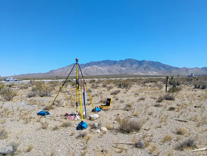
Mike Cody Land Surveying works with clients who need boundary surveys, lot surveys, record surveys, boundary and easement exhibits, topography surveys, construction staking, FEMA certificates, lot line adjustments, and legal descriptions for deeds and surveying purposes.
Boundary surveys help identify property lines, boundary evidence, and important site conditions. This is especially helpful in Phelan where properties may be larger, more rural, or less visibly defined than urban lots.
Lot surveys provide useful information about a parcel’s dimensions, shape, and site layout. They can support property purchases, sales, improvements, and general land planning.
Record surveys help document surveyed information and support accurate land records. They may be needed when property conditions, boundaries, or improvements require formal documentation.
Boundary and easement exhibits provide clear visual references for access, utility areas, parcel limits, or other land-use details that may affect a property.
Topography surveys show elevations, slopes, drainage patterns, and existing features. These surveys are useful for planning, grading, building design, and site development.
Construction staking helps contractors transfer design information to the field so grading, foundations, utilities, driveways, and other improvements can be placed accurately.
Not every project needs the same type of survey. The right service depends on whether you are trying to define boundaries, prepare for construction, review site conditions, support a permit, or document land information for a transaction.
| Surveying Service | Common Use in Phelan | Helpful For |
|---|---|---|
| Boundary Survey | Understanding property lines, corners, and boundary conditions | Landowners, buyers, sellers, homeowners |
| Lot Survey | Reviewing parcel layout, land dimensions, and property conditions | Vacant land, rural lots, residential parcels |
| Topography Survey | Mapping elevation, slopes, drainage, and existing features | Builders, designers, engineers, property owners |
| Construction Staking | Marking layout points for construction and site improvements | Contractors, grading crews, construction projects |
| FEMA Certificates | Providing elevation or flood-related information when needed | Insurance, permitting, property review |
| Legal Descriptions | Preparing written descriptions for deeds or survey documentation | Transactions, records, lot adjustments |
Phelan has many properties where visible improvements do not always tell the full story of the land. A fence, driveway, access road, utility route, or natural feature may not match the actual legal boundary. That is why a professional survey can be important before making decisions about improvements, purchases, sales, or development.
For rural landowners, a survey may help clarify the usable area of a parcel, identify boundary-related questions, support access planning, or provide information needed before discussing construction with designers and contractors. For homeowners, surveying can help before fencing, adding structures, planning a driveway, or preparing documentation for a sale.
For contractors and builders, accurate surveying helps reduce confusion during layout and construction. Construction staking can help ensure that improvements are placed according to the intended plans. Topography surveys can help design professionals understand slopes, drainage patterns, and existing site conditions before preparing plans.
Mike Cody Land Surveying brings more than two decades of High Desert experience to projects like these. That local experience matters because Phelan land can involve wide parcels, open desert terrain, rural access, and boundary conditions that require careful attention.
The surveying process begins with understanding your property and the reason you need survey support. A property owner installing a fence may need a different service than a contractor preparing for construction, a buyer reviewing vacant land, or a landowner preparing a lot line adjustment.
Provide the property location, parcel details, and project goal.
Available property records and project information are reviewed.
Measurements and site information are gathered in the field.
Survey information is prepared for your project needs.
Land surveying in Phelan can support a wide range of property needs. Some clients need survey information because they are buying or selling vacant land. Others need help before improving an existing residential property. Some projects involve construction layout, grading support, boundary exhibits, or legal descriptions for documentation.
A survey can be especially helpful when the land is open, partially improved, or difficult to visually interpret. In some cases, owners may not know where the usable portion of the parcel begins or ends. In other cases, old fencing, informal roads, or neighboring improvements may create questions that should be reviewed before work begins.
By working with a licensed professional land surveyor, property owners can make decisions with more reliable information. Surveying does not replace legal advice or agency review, but it can provide the measured data and documentation needed to support the next step.
Mike Cody Land Surveying provides land surveying services for Phelan and nearby High Desert areas. Services are designed to support property owners, contractors, real estate professionals, and development teams who need accurate land information.
If you are unsure what type of survey you need, start by explaining the property issue or project goal. Common reasons include defining property lines, preparing to build, adjusting a lot line, creating a legal description, reviewing topography, supporting FEMA-related documentation, or staking construction improvements.
You should consider requesting a land survey before building improvements, installing fencing, buying or selling property, adjusting a lot line, planning construction, or resolving uncertainty about property boundaries.
A boundary survey is typically used to help identify property lines and boundary-related conditions. This can be helpful for rural parcels, residential properties, vacant land, and projects where boundary clarity is important.
Yes. Topography surveys can be useful for properties with slopes, drainage considerations, grading needs, or planned construction. They help document elevations, natural features, and existing site conditions.
Yes. A survey may help a buyer better understand parcel boundaries, site conditions, access considerations, and land information before making decisions about a vacant property.
You can request a quote by providing the property address or parcel information, the type of survey needed, and any project details such as building plans, boundary questions, deadlines, or agency requirements.
Get professional land surveying support from a licensed High Desert land surveyor with more than 20 years of local experience.